Skip to content
26/11/19

Jet Streams: Mid-Latitude Modulators!

Written by Simon Lee
PhD student, Department of Meteorology, University of Reading
@SimonLeeWx

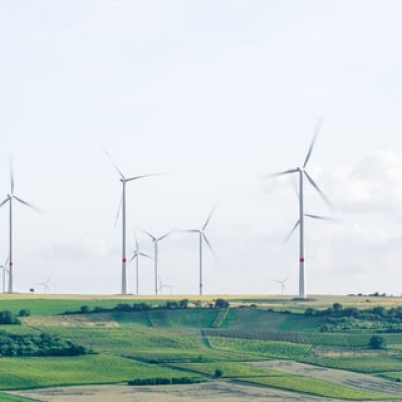
Jet streams are narrow bands of fast flowing air in the atmosphere (Figure 1) that take on many forms across the globe. However, in the mid-latitudes, including Europe, the jet stream of greatest interest is the polar jet stream. It is one of the most widely discussed weather phenomena in the world, even now featuring regularly in public weather broadcasts. But what exactly is it?

Figure 1: Climatological (1979-2017) annual-mean west-east jet stream winds (250 hPa) according to the NCEP/NCAR reanalysis dataset.
     Essentially, the polar jet stream (hereafter, the jet stream) forms due to the difference in temperature between the pole and the equator (the meridional temperature gradient). This difference is strongest in winter, so the jet stream is strongest in winter. Winds in the jet are mostly westerly and increase in speed with height – called thermal wind shear – reaching their maximum (often exceeding 200 mph in winter) at around 10 km or so. Because of its maximum at a high altitude, the jet stream is important in commercial flight operations. For example, eastbound transatlantic flights can use the strong tailwinds to their advantage, and the subsonic transatlantic flight time-record was associated with an unusually strong jet stream. The jet streams also play an important role in balancing the amount of momentum in the Earth system. 
 
     The jet stream sits on the boundary between the cold polar airmasses and the warm subtropical airmasses, which is where the meridional temperature gradient is strongest. Here, low-pressure and high-pressure systems form, directly associated with the behaviour of the jet stream. These can modify the temperature gradient, and act in a two-way relationship to distort the jet stream into huge waves thousands of kilometres across – called Rossby waves. The jet acts as a guide for these storm systems, and in this sense is the storm track. And this is why we care so much about the jet stream – its position and intensity directly modulate the weather on its eastern edge, which in the Atlantic sector is Europe. 
 
     The jet’s westerly winds are why Europe sees weather systems tend to come in off the Atlantic, and they help keep western European climate relatively mild in winter. When the jet is further north, Atlantic storm systems and their associated wind, rain, and cooler weather are further north – and vice versa. When the jet is strong, there tend to be stronger storm systems. When the jet is very wavy, it also tends to move weather systems along less quickly – like water flowing along a meandering river – which can result in extremes of heat and cold, flooding and drought. Since it modulates the local climate of Europe so much, it is important to consider how climate change may be impacting the jet stream. It turns out this is a rather complex issue that remains an area of active research.
 
Figure 2: The Jet stream over the North Atlantic-European sector. Source: Met Office
 
       Part of the reason it is so complex is due to an atmospheric ‘tug-of-war’. In the lower 5 km of the atmosphere, in the Northern Hemisphere, the temperature difference between the equator and pole is weakening because the Arctic is warming faster than anywhere else (known as Arctic Amplification) due to anthropogenic climate change. In the upper atmosphere at around 10 km, this same temperature difference is strengthening, also because of anthropogenic climate change – because at this altitude, the tropical regions are warming faster than the polar regions. The stratosphere is cooling due to increasing greenhouse gas concentrations, whilst the troposphere is warming, so this leads to an enhanced temperature difference at high altitudes. The speed of the jet stream ultimately depends mostly on how these ‘tugs’ balance out (assuming other dynamical factors remain the same). 
 
     Should the lower-level ‘tug’ win, the jet stream would weaken, and along with that it would tend to shift equatorward. A weaker jet is also more likely to be wavy, causing slower-moving weather systems leading to localised climatic extremes. Should the upper-level ‘tug’ win, the jet stream would strengthen and shift poleward, likely alongside an increase in storminess. The climatic consequences could be profound in either case and may act to regionally dilate or enhance the global warming signal. For example, an equatorward jet shift in summer would tend to cause cooler and wetter summers in the UK – quite the opposite of the expectation of more heatwaves, which would be more likely if the jet shifted poleward. However, a weaker jet may also lead to more heatwaves by moving weather systems more slowly. The changes may not be seasonally consistent, either – there is a strong seasonality to the rapid warming of the Arctic, for example, which means the ‘tugs’ could go different ways in different seasons. Changes to the sea surface temperature profile in the Atlantic – either human-caused or due to natural variability – may also impact the typical latitude and behaviour of the jet. You can quickly see how this is so difficult, yet so crucial for projections of local climate change!
 
     A recently study I led, alongside Professor Paul Williams and Dr Thomas Frame from Reading Meteorology, found that over the last four decades, the North Atlantic jet stream has not significantly changed in speed or latitude (i.e., the ‘tugs’ are balanced) – but it has become 15% more sheared at transatlantic aircraft cruising altitudes. We relate this increase in shear to changes in the upper-level temperature gradient due to anthropogenic climate change. Wind shear is an important driver of clear-air turbulence, a major aviation hazard, which has been projected to increase due to climate change. Our study suggests this may already be happening and supports these future projections, showing just how impactful changes in the jet stream are even beyond day-to-day weather.
 
     Understanding the response of the jet streams to climate change is thus vitally important for regional climate change. In-situ observations of jet streams are rare, so we rely mainly on satellite observations – which only widely began in the late 1970s. Thus, we have about four decades of coherent data, and as a result only now are we really being able to say conclusive statements about observed changes in the jet stream and fully understand how its variability modulates mid-latitude climate change.

References

Mann, M. E., S. Rahmstorf, K. Kornhuber, B. A. Steinman, S. K. Miller & D. Coumou (2017). Influence of Anthropogenic Climate Change on Planetary Wave Resonance and Extreme Weather Events

You may be interested in reading about

All articles

2/3/21

An overview on climate sensitivity

Human-induced climate change, driven by increasing emissions of atmospheric greenhouse gases, remains an ever-increasing issue at the centre of climate science whilst also having implications for society, policymakers and governing-bodies.

1/3/21

The energy charter treaty

A new law on climate change and the energy transition is about to come to light in Spain, with the aim of limiting global warming to 1.5 degrees and meeting the pledges made by the European Union at the Paris Agreement.

19/1/21

Delhi and the River of Love

As I drove by the bridge on the river Yamuna, it looked calm, serene, and inviting. However, getting closer, the unmistakable smell of decay greeted me. The banks were full of rubbish and the river was black. The stillness of the calm and serene river turned out to be death.

15/6/20

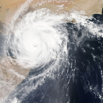
Forecasting tropical cyclones in a changing climate

Most of us engage with weather forecasts when we’re trying to plan our weekends, but they can also help us understand and cope with our rapidly changing climate.